Point Conception Institute

A living laboratory
Research conducted at the Preserve focuses on understanding the ecological function of the Preserve while contributing to the broader goals of conserving biodiversity. TNC’s research provides the scientific foundations for stewardship, protection, and restoration while exporting this knowledge to advance conservation policy and land management.
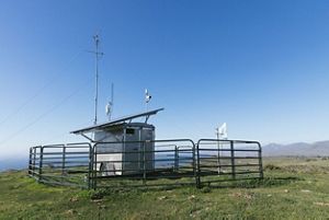

MOTUS Tower: MOTUS tower and trailer at Dangermond Preserve. © Erin Feinblatt/TNC
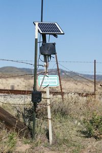
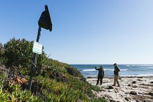
Camera Trap: Camera trap at the Dangermond Preserve. © Erin Feinblatt
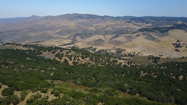
Ecosystem Overview: Mark Reynolds, PCI Director, provides an overview of Dangermond Preserve’s ecosystems. © TNC
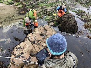
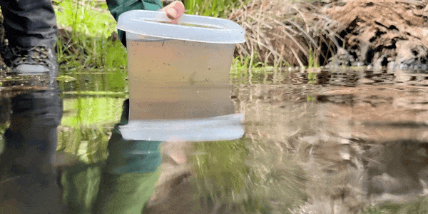
Intertidal Research: UCSC researchers use iPads to enter over 3,300 data entries along transects during low-tide intertidal biodiversity surveys. © Walter Heady/TNC
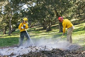
SB TREX 2022: Preserve scientist and stewardship manager conduct mop-up on a pile burn. © Erin Feinblatt/TNC
About the Institute
The Point Conception Institute (PCI) is a global conservation science center based at The Nature Conservancy’s (TNC) Jack and Laura Dangermond Preserve. PCI’s impact model leads to faster, more adaptive conservation in critical places.
We harness the power of open science by facilitating diverse research collaborations, data stewardship and sharing, and technology applications to protect biodiversity, restore ecosystems, and address climate change with innovative solutions.
PCI by the Numbers
-

>203
career development opportunities
-

>122
research projects
-

>236
new data sets
-

>55
partners building the program
PCI Vision
Our vision is a place of intentional collaboration, where researchers bring ideas and energy, leverage the unique ecological assets of the Preserve for breakthrough conservation science, and commit to cross-pollinating their approaches and findings both while at the Preserve and beyond.
We believe open data is an essential ingredient to accelerating conservation research and decision-making, and that the data systems and technology infrastructure created here will have an impact beyond the sum of individual projects.

This graphic states that Point Conception Institute’s impact model leads to faster, more adaptive conservation in critical places. Under the category of place, research partnerships, and technology, it lists the Jack and Laura Dangermond Preserve Living Laboratory, Cutting-Edge Research and Diverse Partners in Academia, NGOs, and Government, and Innovative Tech for Local and Remote Data Collection. It also mentions the open-data platform also known as Digital Twin, as well as Strategic Research Initiatives, which leads to co-production and dissemination of knowledge and collective impact in the form of faster, more adaptive conservation in critical places.
PCI and Our Collaborators
The Point Conception Institute set out to build an active and coordinated conservation research community that would work synergistically to advance our understanding of California’s coastal ecosystems, with the goal of more effectively protecting, managing, and restoring critical habitat. Over the years, PCI has facilitated collaborations between TNC; Esri; University of California, Santa Barbara; National Aeronautics and Space Administration (NASA); National Geographic Society; Smithsonian Institution; Vandenberg Space Force Base; National Center for Ecological Analysis & Synthesis (NCEAS) and other institutions to support and accelerate research initiatives. Specific examples of our research collaborations include the deployment of Esri mobile data collection tools to support field research, and the development with NASA of new approaches for applying satellite-based information to manage freshwater, coastal, and terrestrial ecosystems and conserve biodiversity. We continue to grow our research partnerships, come join us!

Research
The Jack and Laura Dangermond Preserve is focused on learning, innovation, preservation, and restoration. Learn more about how to get involved in research on the Preserve.
Research Initiatives
Initiatives are focused areas of work that bring together research, partnerships, and innovation to address key conservation challenges. Each initiative outlines a vision for impact, guides collaborative efforts on the Preserve, and helps generate insights that can be applied across California and beyond. We describe our four initiatives below: Protecting the Preserve, The Wild Coast, Healthy Watersheds, and the Digital Twin for Conservation.
Protecting the Preserve
At the heart of the Point Conception Institute’s mission is a commitment to protecting the ecological integrity and cultural richness of the Preserve. Through innovative science, inclusive partnerships, and scalable conservation strategies, we are building a model for how protected areas can thrive in a changing world. This initiative focuses on landscape-scale interventions, long-term ecological monitoring, and collaborative stewardship—especially with the Chumash community—to ensure the Preserve remains a living laboratory and a beacon of resilience. Our work generates insights that extend far beyond our boundaries, informing conservation practices across California and beyond.
Click on these links for more information and to access data and tools related to Rangeland Management, Fire, Oak Restoration, and Preserve Operations.
Featured Projects
Protecting the Preserve
-
At the Jack and Laura Dangermond Preserve, we’re transforming 150 acres of former agricultural land back into thriving oak habitat. Coast live oaks are vital to California’s ecosystems, supporting a rich diversity of plants and animals that depend on these iconic trees.
Using a dynamic dashboard, our ecologists track progress across five restoration zones, each designed with different planting densities—from dense woodlands to open oak savannas. Trees are planted as acorns, seedlings, or saplings, and each is tested with various protection methods to guard against gophers, squirrels, deer, and cattle.
Over the next five years, we’ll monitor the health and survival of each tree to learn which techniques work best. These insights will be shared with the broader oak restoration community to support habitat recovery across California.
-
At the Jack and Laura Dangermond Preserve, The Nature Conservancy and our partners at Rancho San Julian are using conservation grazing to restore and maintain California’s coastal grasslands. Through our rangeland program, we manage cattle grazing to reduce wildfire risk, control invasive species, and support native biodiversity.
Our approach aims to balance ecological goals with operational realities. We rotate cattle across pastures to allow for rest and recovery, and are investing in new infrastructure and technologies to help us monitor, plan, and encourage more streamlined and sustainable operations.
This program is part of a broader effort to demonstrate how well-managed grazing can support resilient ecosystems, vibrant rural economies, and long-term conservation success.
-
Fire presents both challenges and opportunities at the Jack and Laura Dangermond Preserve. Catastrophic wildfires in the Western United States, driven by drought, climate change, and land management practices mean that fire can pose a risk to the biodiversity and safety of people on the Preserve. However, prescribed fire or “beneficial fire” can also be used as a tool in our conservation toolbox to support biodiversity and to reduce the risk of catastrophic wildfires moving across the Preserve. PCI is in a unique position to combine the practical needs of stewarding the land with scientific research. We are teaming up with a suite of partners, including researchers from Cal Poly SLO, UCSB, Sedgwick Reserve, Santa Barbara County Fire Safe Council, and Santa Barbara County Fire, to study the impacts of fire and provide guidance to land managers and agencies on how to develop fire plans that both reduce fire risk and help reach ecological objectives. Click here to learn more about our fire related work.
The Wild Coast
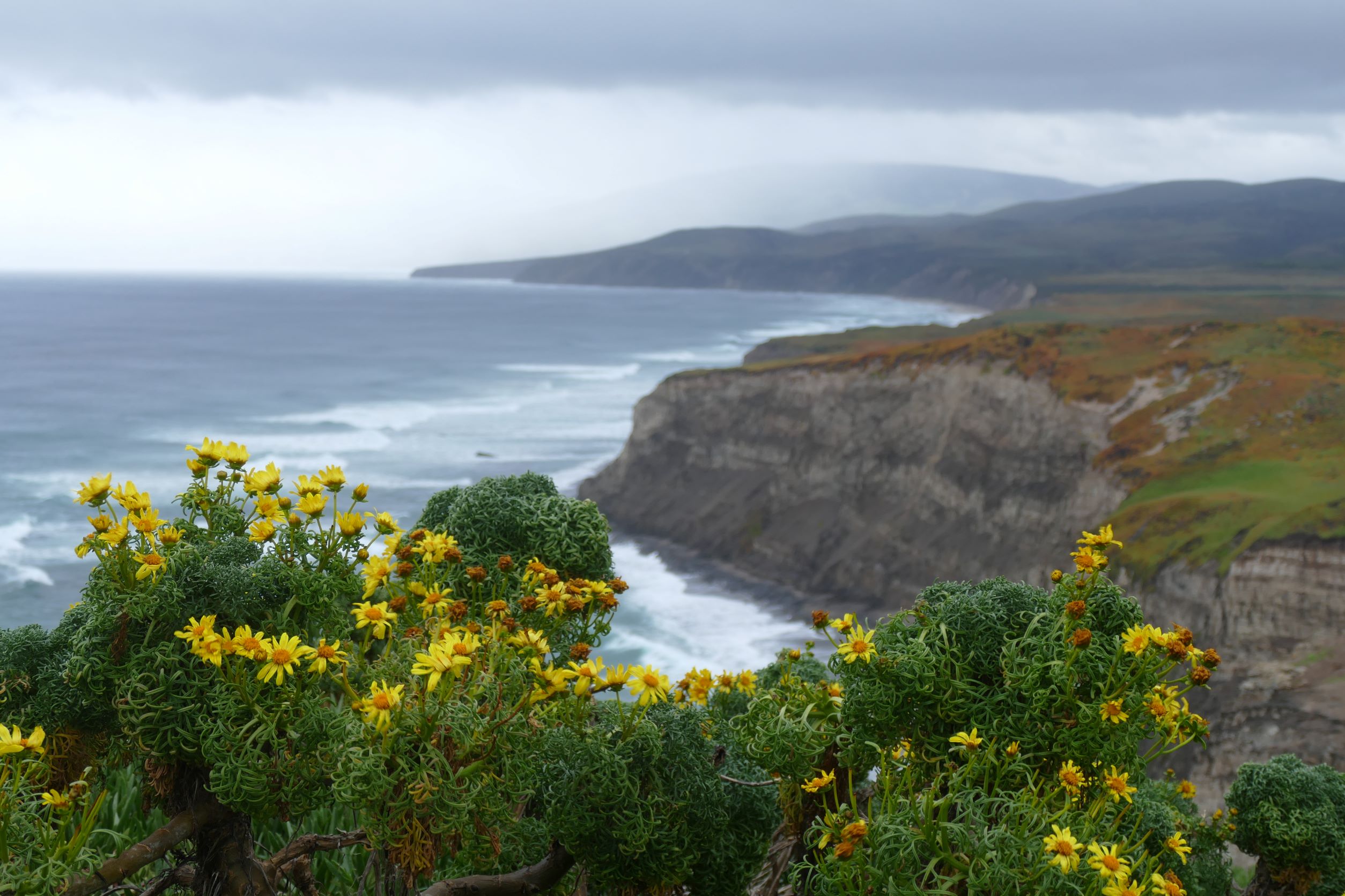
The Wild Coast initiative explores one of California’s most ecologically dynamic regions—where ocean currents collide and biodiversity thrives. At the Point Conception Preserve, the meeting of cold and warm marine systems creates a rare biogeographic boundary zone, rich in species diversity and ecological complexity. With partners, we’re documenting and monitoring this unique marine-terrestrial interface to understand how climate change is reshaping species distributions and ecosystem dynamics. By using cutting-edge tools like drone imagery and environmental DNA, we’re capturing real-time biodiversity data and tracking shifts in ecological baselines—laying the groundwork for informed conservation across California’s coastline.
To further conservation efforts, PCI has published a paper “The importance of identifying and protecting coastal wildness” that highlights that while 35% of California’s coast has wildness attributes, only 9% is protected on both land and in the adjacent waters. The paper along with a Storymap and TNC’s California Wild Coast Modeler, provide tools for targeted conservation with the highest impact.
Click the link for more information and to access data and tools related to the Wild Coast.
Featured Projects
The Wild Coast
-
The region around Point Conception and the Jack and Laura Dangermond Preserve is a unique ecological crossroads—where northern and southern California ecosystems meet. As climate change reshapes habitats, understanding how species might shift across this transition zone is critical. Several projects at the Preserve are addressing this challenge, including a collaborative project led by Dr. Gio Rapacciuolo and supported by The Nature Conservancy’s Point Conception Institute that compiled observational data to begin to model species ranges and define, through literature review, the scientific support for this area being considered an ecological transiton zone.
In another project graduate students from UCSB, guided by Professor Amy Frazier, developed models for 45 key species. These models help predict how plant and animal communities may move or change in the future.
Dr. Erica Neilsen, Dr. Pete Raimondi, and others are also leading work to understand species ranges shifts in the intertidal using data from the MARINe project.
Explore this innovative work through an interactive biodviersity portal and final presentation that reveal how biodiversity may evolve in this dynamic landscape.
-
We’re working to restore 300 acres of coastal prairie, dunes, and wetlands by removing invasive iceplant—a species that disrupts natural ecosystem processes and displaces native plants. This large-scale restoration effort is guided by the Iceplant Restoration Science Working Group and supported by cutting-edge research and technology.
To better understand the spread of iceplant, we’ve partnered with NCEAS and NASA’s Jet Propulsion Laboratory to map its extent using satellite imagery and machine learning. This has resulted in the most comprehensive assessment of iceplant along the Santa Barbara County coast to date.
We’re also learning from local research, including studies by UCSB’s Nick Saglimbeni on effective iceplant removal and native plant recovery techniques. In addition, UCSB researchers Madison Heffentrager and Ian Walker are studying how sand moves and dunes recover after iceplant is removed—key insights for long-term restoration success.
Together, these efforts are helping us bring back the natural beauty and ecological function of California’s coastal landscapes.
-
Establishing thriving Rockweed Populations
Silvetia compressa, a type of rockweed found along California’s coast, plays a crucial role in the local marine ecosystem. It provides food and shelter for over 100 species. Traditional restoration methods involve moving whole plants from healthy populations, which can unintentionally harm donor sites. To find a more sustainable solution, we’re testing a new approach: growing young Silvetia in a lab from fertile branches collected at the Dangermond Preserve, then planting them back into the wild. This method could help restore vital coastal habitats while protecting existing ones.
Bringing Black Abalone Back from the Brink
Black abalone, once abundant along California’s coast, have faced steep declines due to overfishing, disease, and climate change. Now, researchers from The Nature Conservancy, UC Santa Cruz and NOAA Fisheries are working to restore this endangered marine snail at the Jack and Laura Dangermond Preserve. In 2023, scientists carefully translocated healthy black abalone from surviving populations to the Preserve’s rocky coastline—one of the few undisturbed habitats left.
Early results are promising: surveys show that many of the translocated abalone have survived and settled into their new home. This effort not only supports species recovery but also honors the cultural significance of black abalone to coastal Native communities. Ongoing monitoring will help determine if these resilient creatures can begin to reproduce and reestablish a thriving population.
Healthy Watersheds
The Healthy Watersheds initiative focuses on studying and managing one of California’s connected coastal freshwater system to better understand hydrological processes, ecosystem dynamics, and restoration outcomes.. Encompassing over 90% of the Jalama Creek watershed, the Preserve offers a rare opportunity to study how water moves from headwaters to the ocean, from surface water to ground water. Through innovative research, restoration, and stewardship—including the creation of a freshwater digital twin—we’re gaining new insights into the connections between land use, climate resilience, and aquatic health. Our work is restoring 21 miles of spawning habitat for endangered Southern Steelhead and protecting vital riparian ecosystems, with lessons designed to scale to nearby watersheds.
Click these link for more information and to access data and tools related to the Freshwater and Pond Restoration.
Featured Projects
Healthy Watersheds
-
Understanding how water moves through fractured rock aquifers is key to protecting California’s water resources—especially in coastal regions like the Jack and Laura Dangermond Preserve. In December 2023, we developed a report, Falling Through the Cracks, highlighting the scientific findings at the Preserve and providing recommendations for actionable conservation strategies as we continue to invest in research in this area.
In partnership with researchers from UCSB, including hydrologist Scott Jasechko, The Nature Conservancy is pioneering new methods to monitor groundwater recharge in real time.
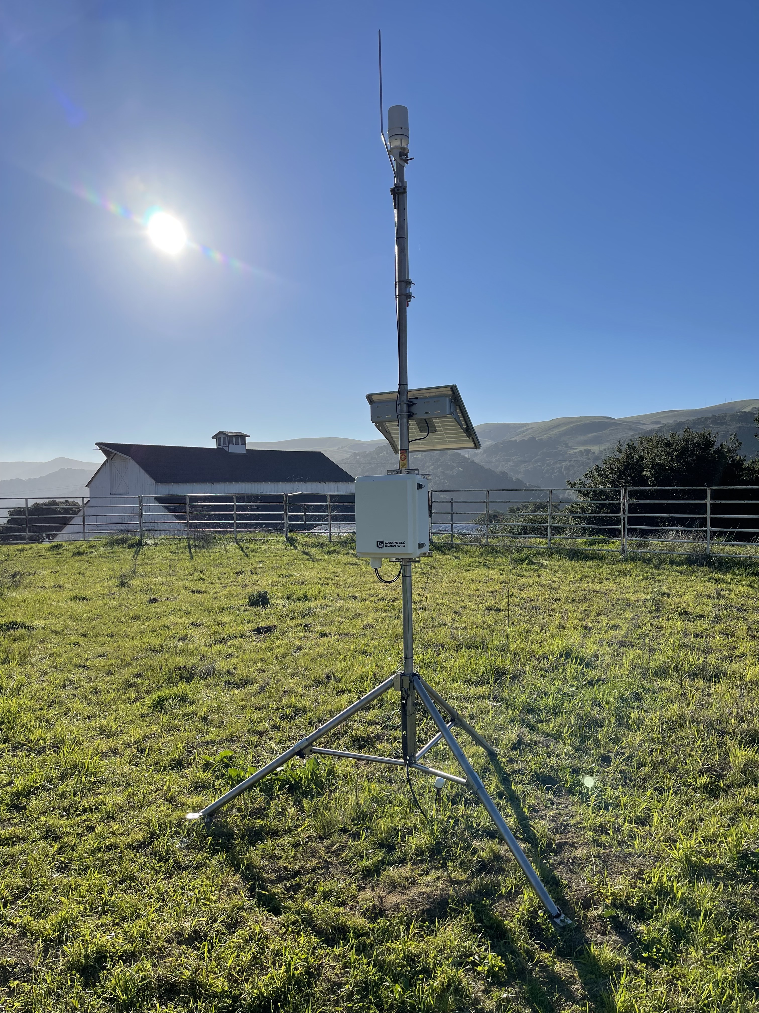
Using a network of Ranchbot, and other sensors—many installed on remote ridgetop wells—our team is collecting live data on groundwater levels, rainfall, and streamflow. This system represents one of the densest groundwater monitoring networks globally, offering a rare look into recharge dynamics.
This work is part of a broader effort to build a “digital twin” of the watershed, enabling scientists to model water movement and test restoration strategies. Insights from this project will help inform sustainable water management practices and support the recovery of streamflow-dependent ecosystems across California.
-
The Central Coast Ambient Monitoring Program (CCAMP), led by the Central Coast Regional Water Quality Control Board, is conducting long-term water quality monitoring at Jalama Creek. This site helps track trends in water quality over time, supporting efforts to protect and restore central California’s coastal waters.
Ambient measurements include pH, temperature, dissolved oxygen, turbidity, and salinity, along with quarterly sampling for nutrients and other indicators. All data collection follows the State Water Board’s SWAMP Quality Assurance Program Plan and is shared publicly via https://www.ceden.org and the http://www.ccamp.org.
To complement this work, researchers Walter Heady and Matt Mensinger have deployed a network of dissolved oxygen and temperature loggers throughout Jalama Creek. These sensors are strategically placed in pools and tributaries to assess steelhead habitat suitability, detect groundwater contributions, and monitor seasonal changes in water quality. The deployment includes HOBO MX800 Series loggers and dissolved oxygen sensors, with multiple sensors installed at different depths to capture stratification and cold-water refugia.
This integrated monitoring effort is helping scientists understand how habitat conditions evolve and guiding restoration strategies to support endangered species like Southern California steelhead.
-
At the Jack and Laura Dangermond Preserve, The Nature Conservancy is restoring vital habitat for endangered Southern California steelhead by removing two major barriers to fish passage along lower Jalama Creek. These concrete and bridge structures previously blocked the seasonal movement of juvenile and adult steelhead, preventing access to over 12 miles of high-quality spawning and rearing habitat.
By removing these impediments, we’ve taken the first steps toward reconnecting up to 21 miles of stream—from the Pacific Ocean to the upper watershed. This effort not only supports steelhead recovery but also benefits other sensitive species, including the tidewater goby, California red-legged frog, and western pond turtle.
With 94% of the Jalama Creek watershed protected within the Dangermond Preserve, this project represents a rare opportunity to restore an intact coastal ecosystem and help endangered species thrive once again.
Digital Twin for Conservation
The Digital Twin for Conservation initiative will revolutionize how we collect, interpret, and apply ecological data to guide conservation decisions. By building a dynamic virtual model of the Preserve’s ecosystems—powered by real-time sensor networks, spatial data, and ecological simulations—we will be able to test conservation strategies, forecast outcomes, and support adaptive management. This digital twin will help us move from data to action more quickly, manage resources more sustainably, and scale insights across landscapes. As we develop, we aim to foster open science, open data, enhance stakeholder engagement, and create powerful tools for conservation, planning, and long-term ecological resilience.
See more about this work here.
Featured Projects
Digital Twin for Conservation
-
PCI partnered with NASA-Jet Propulsion Lab and University of California on Project SHIFT (for Surface Biology and Geology High Frequency Time series). This is a first-of-its-kind deployment of AVIRIS (Airborne Visible/InfraRed Imaging Spectrometer) optical sensor technology and on-the ground vegetation sampling to calibrate and validate vegetation observations for NASA’s Surface Biology and Geology (SBG) mission. This coordinated effort will, for the first time, document large-scale seasonal change in vegetation of Mediterranean ecosystems through weekly flyovers coupled with ground-based sampling. Check out the data and SHIFT media and stay tuned for emerging research.
-
Dangermond Preserve’s Jalama watershed is a medium-sized, intact southern California watershed. Without major dams, diversions, or development, over 90% of the watershed is within The Nature Conservancy’s conservation ownership of the Dangermond Preserve. This makes it ideal for deploying a combination of ground-based, airborne, and satellite sensing to create pipelines of data on freshwater ecosystems—a freshwater digital twin.
Through the development of a wireless network of weather stations, stream gauges, and groundwater level loggers, and in situ sampling of isotopes and water quality we are working with partners (UCSB, etc) to understand the “pulse” of the Preserves freshwater resources and use information pipelines to make sustainable water decisions.
Specifically, our goal is to:
- Develop data and evidence to guide conservation actions in ecologically similar, but more impaired, watersheds (e.g., impaired watersheds throughout the global Mediterranean biome).
- Create and demonstrate efficient, technologically-enabled approaches for monitoring data-poor freshwater systems.
- Create a rich database (digital twin) to allow for new approaches and integration of in situ data with airborne and satellite technologies for water system monitoring.
- Invest directly in developing scalable approaches by convening water resource managers and decision makers, presenting approaches, data and findings to help determine the impact pathway forward.
-
To support a growing community of researchers and conservation practitioners, The Nature Conservancy has built a powerful digital ecosystem at the Jack and Laura Dangermond Preserve. At the heart of this system is the Research Application Management Portal (RAMP)—a custom Salesforce-based platform that streamlines the research approval process. RAMP allows applicants to submit proposals, track progress, and receive updates, while staff manage workflows, approvals, and reporting.
Complementing RAMP is the Research Repository for Data Discovery (R2D2), a public-facing portal hosted on the DataONE network. R2D2 provides open, secure access to well-documented Earth observation datasets, making it easier for researchers to publish, discover and share data from the Preserve
All of this is integrated with the Dangermond Geospatial Hub, a dynamic online platform where anyone can explore interactive maps, dashboards, and stories about the Preserve’s science and stewardship. From freshwater monitoring to fire management and species tracking, the Hub showcases how geospatial data is driving conservation outcomes.
Together, RAMP, R2D2, and the Geospatial Hub form a robust digital backbone for conservation science—supporting transparency, collaboration, and innovation across disciplines.

Mark Reynolds: Director of the Point Conception Institute in California. © TNC
Intertidal Research: UCSC researchers use iPads to enter over 3,300 data entries along transects during low-tide intertidal biodiversity surveys. © Walter Heady/TNC
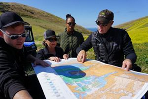
Dangermond Preserve Map Review: TNC scientists review a map at Dangermond Preserve. © Aliya Rubinstein/TNC
Science in action: PCI Director of Conservation Technology, Kelly Easterday, flying UAV over Jalama Road after fire. © Mark Reynolds/TNC
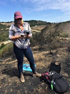
Beach camera trap: Elizabeth Hiroyasu and Moses Katkowski with coastal wildlife camera. © Erin Feinblatt/TNC
Kelly Easterday: Director of Conservation Technology at the Jack and Laura Dangermond Preserve and Point Conception Institute. © TNC
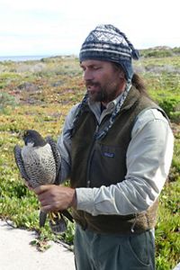
Biologist Nick Todd and bird: Biologist Nick Todd tags a peregrine falcon at the Dangermond Preserve. © Jay Carlson/TNC
Camera Trap: Camera trap at the Dangermond Preserve. © Erin Feinblatt
Ecosystem Overview: Mark Reynolds, PCI Director, provides an overview of Dangermond Preserve’s ecosystems. © TNC

PCI Fellows
PCI seeks to develop the next generation of conservation leaders focused on pressing conservation challenges by hosting and mentoring early career investigators as PCI fellows.

Point Conception Institute Newsletters
Read the latest newsletters from Point Conception Institute at the Jack and Laura Dangermond Preserve.
Publications
See lists below for select recent publications from the PCI team and our partners related to research and reports from the Dangermond Preserve and the Point Conception Institute. Click the button below to find a more comprehensive list of publications.

PCI Select Recent Publications
- Nielsen, Erica S., et al. “The Effects of Latitudinal Gradients, Climatic Anomalies, and Size-Selective Harvesting on the Adaptive Potential of an Intertidal Gastropod”, Evolutionary Applications, vol. 18, 2025, p. e7015.
- Markman, Bruce, et al. “Evaluating UAV LiDAR and Field Spectroscopy for Estimating Residual Dry Matter Across Conservation Grazing Lands.” Remote Sensing, 2025.
- Chadwick, K.D., K. Easterday, M.D. Reynolds…et al. 2024. “Unlocking Ecological Insights from Sub‐seasonal Visible‐to‐shortwave Infrared Imaging Spectroscopy: The SHIFT Campaign.” Ecosphere, vol. 16, no. 3, 2025, p. e70194.
- Khodaee, M., Easterday, K. and Klausmeyer, K. (2024). Integrating hydrological parameters in wildfire risk assessment: A machine learning approach for mapping wildfire probability. Environmental Research Letters.
- Easterday, K., and M. D. Reynolds. 2024. A Digital Twin of the Dangermond Preserve fosters open science. ArcNews Fall 2024.
- Nielsen, Erica S., et al. “Pushed Waves, Trailing Edges, and Extreme Events: Eco‐evolutionary Dynamics of a Geographic Range Shift in the Owl Limpet, Lottia Gigantea.” Global Change Biology, vol. 30, no. 7, 2024, p. e17414.
- Genua, Lucy, et al. “Spatial patterns of vegetation change in a fire-suppressed coastal California landscape.” Madroño, vol. 70, no. 4, May 2024.
- Gleason, M.G., Reynolds, M.D., Heady, W., Easterday, K. and Morrison, S.A. 2023. The Importance of Identifying and Protecting Coastal Wildness. Frontiers in Conservation Science, 4, p.1224618.
- Rohde, M.M., M. Reynolds, K. Easterday. 2023. Falling through the cracks: Pathways for conserving California’s coastal ecosystems. The Nature Conservancy. San Francisco, California. (.pdf)
- Wright, Dawn, and Kelly Easterday. “Environmental Digital Twins and Earth Stewardship.” Esri, 20 Apr. 2023
PCI Select Recent Partner Publications
- Araki, Ryoko, et al. “Nonlinear Soil Moisture Loss Function Reveals Vegetation Responses to Water Availability.” Geophysical Research Letters, vol. 52, no. 11, June 2025, p. e2024GL111403.
- Angel, Yoseline, et al. “Deciphering the Spectra of Flowers to Map Landscape‐scale Blooming Dynamics.” Ecosphere, vol. 16, no. 2, 2025, p. e70127.
- McEvoy, Susan L, et al. “The Reference Genome of an Endangered Asteraceae, Deinandra Increscens Subsp. Villosa , Endemic to the Central Coast of California.” G3: Genes, Genomes, Genetics, edited by P Morrell, vol. 14, no. 8, Aug. 2024, p. jkae117.
- Galaz García, Carmen, et al. “Mapping Invasive Iceplant Extent in Southern Coastal California Using High-Resolution Aerial Imagery.” Ecological Informatics, vol. 81, 2024, p. 102559.
- Marraffini, M.L., Hamilton, S.L., Jarrin, M., Ladd, M., Koval, G., Madden, J.R., Mangino, I., Parker, L.M., Emery, K.A., Terhaar, K., Hubbard, D.M., Miller, R.J. and Dugan, J.E. (2024). Evaluating the influence of marine protected areas on surf zone fish. Conservation Biology.
- Jasechko, S., Seybold, H., Perrone, D., Fan, Y., Shamsudduha, M., Taylor, R.G., Fallatah, O., Kirchner, J.W., Rapid groundwater decline and some case of recovery in aquifers globally. Nature 625, 715–721 (2024).
- Zilz, Z.L., Copeland, S. and Young, H.S., 2023. Consistent foraging on marine resources by coyotes (Canis latrans) on the Southern California coast. Food Webs, 37, p.e00311.
Media
See recent articles and media from projects with the Point Conception Institute and the Dangermond Preserve

Media: Dangermond Preserve & PCI
- New Dangermond Preserve and PCI website
- LA Times: Environmentalists turning rugged stretch of California Coast into a lab for conservation
- KCLU: The Tri-Counties hidden gem: It's a nearly 25,000 acre nature preserve in Santa Barbara County
- KCLU: It's poop to us, but Santa Barbara County researchers say it's a feast of info about carnivores
- SB Independent: Western Monarch Count
MEDIA: Protecting The Preserve
- TNC Newsroom: Santa Barbara Prescribed Fire Training Exchange
- CNPS: How CNPS is working with partners to map millions of acres of vegetation in California - a vital tool in a long-term conservation effort within the state.
- KTLA: NASA takes to the skies for "first-of-a-kind" study of California wildflower blooms
- SB Independent: Bioblitz Reveals Hidden Biodiversity in the Santa Barbara Channel
MEDIA: Healthy Watersheds
Media: Department of Defense REPI (Readiness and Environmental Protection Integration) Conservation Easement on Dangermond Preserve
- Santa Barbara Independent: Historic $15 Million Deal Safeguards Dangermond Preserve from Development
- Santa Maria Sun: Dangermond Preserve now permanently protected
- Edhat: Vandenberg Partners with Nonprofits to Ensure Conservation of Southern California’s Last Wild Coast
- KCLU: Deal insures a 24,000 acre Central Coast nature preserve is permanently protected from development